


CLICK ON AN IMAGE TO ENLARGE THE MAP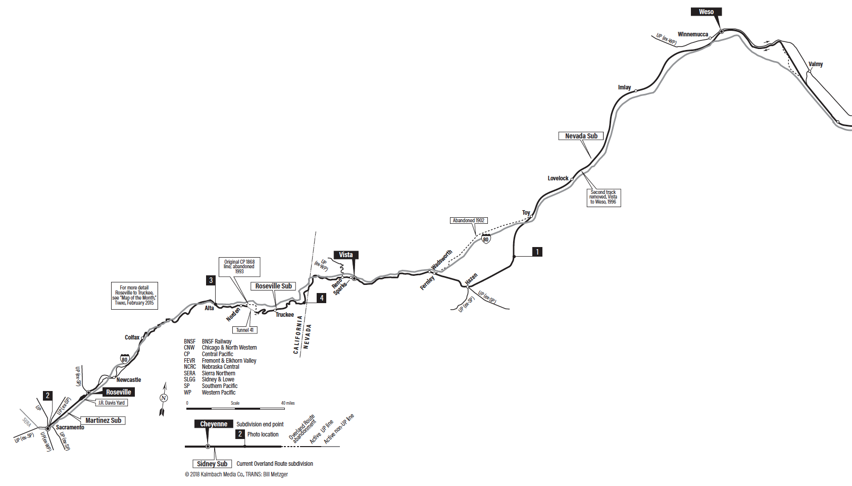
California to Nevada
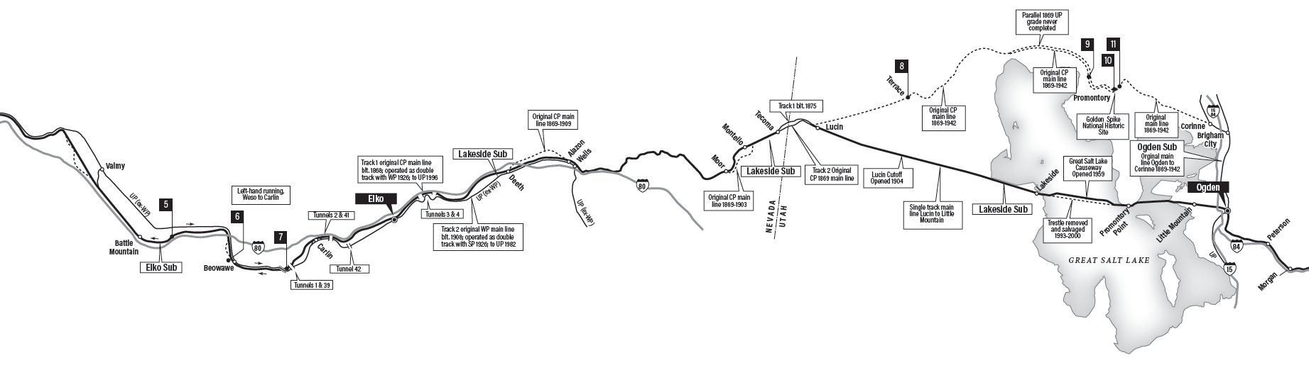
Nevada to Utah
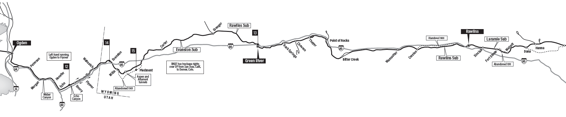
Utah to Wyoming
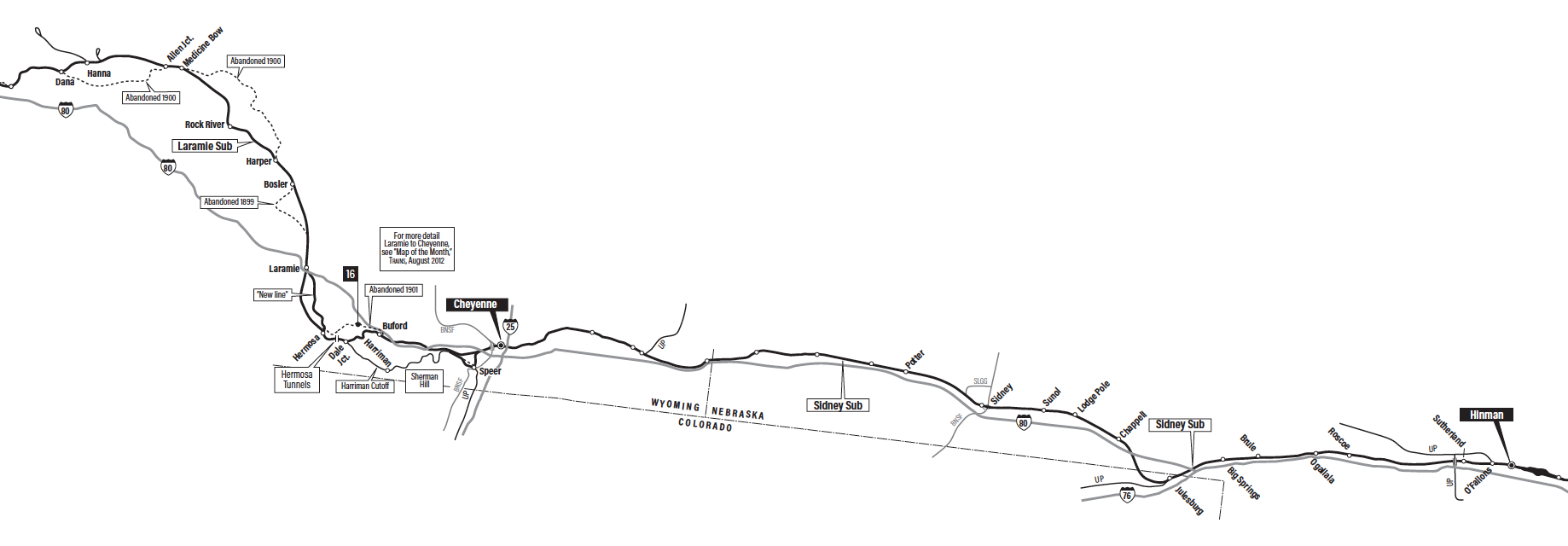
Wyoming to Nebraska
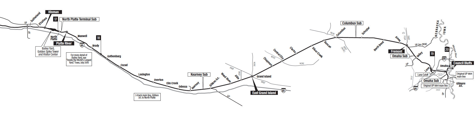
Nebraska to Iowa
The first Transcontinental Railroad was a monumental undertaking by the time workers finished it in 1869.
Today, tourists and enterprising photographers can visit much of what American ancestors left behind 150 years ago. Some of the rights-of-way the Union Pacific and Central Pacific used for the railroad are still in service as railroad lines. Other pieces of the Transcontinental Railroad have become trails, still other are abandoned to the prairies or mountains to be reclaimed by nature.
These map panels illustrating the route of the Transcontinental Railroad are superimposed on top of current cities, place names, and Interstate highways. They are integral to Drake Hokanson’s story, “Following the Golden Spike” featured in Trains‘ special issue: Journey to Promontory.


I see many names I recognize on the maps, so part of what I rode on UP/SP City of St. Louis is still being used. I checked the maps in Journey to Prom mag and enjoyed the pics along with the article. Lots of memories along those places.