Railroad signs
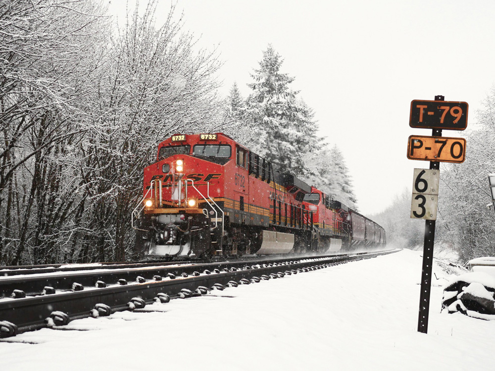
Railroads, like highway systems, use a variety of signs, signals, and identification markers to convey information to railroaders along a route. Railroads have established mileposts – identified by signs, markers, or displays – to give the crew and dispatcher a quick method for identifying their location on a railroad in all weather conditions (day or night).
Knowing the exact time and location of a train was key to a railroader’s safety. All operations ran on strict timing schedules, and in some cases, trains were required to clear a main track by a certain time for a faster (or higher priority) train that was due by. Signs gave railroaders a milepost location that could be clearly displayed and viewed by a passing train at speed.
Some railroads, like the Union Pacific, noted mile posts in quarter mile sections by using a series of hash marks on a sign placed along pole lines adjacent to the main line.
In crowded rail corridors, some railroad locations must be further identified to prevent confusion during the movement of trains. In Tacoma, Wash., e.g., milepost zero starts for the BNSF Seattle Subdivision that heads south toward Vancouver, Wash. Chehalis, Wash., e.g., sits at milepost 57.8, meaning that location is 57.8 rail miles from the starting point in Tacoma, Wash.
Seattle is also the beginning of milepost 0 south to Tacoma (distance of 38 miles) on that section of the Seattle Sub. To differentiate between the Seattle to Tacoma section and the Tacoma to Vancouver section, the Seattle to Tacoma route has the letter “X” after each milepost to identify its location.
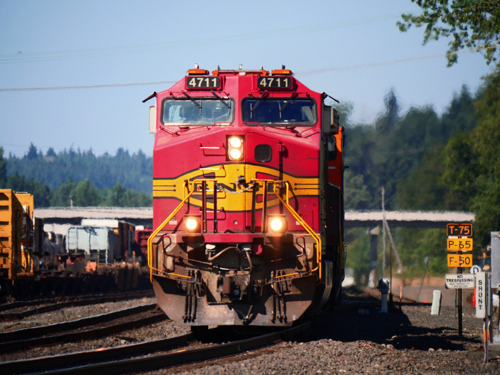
Railroads also post speed limit signs, staging locations, switch components, or track information. Most signs are self-explanatory, but railroads have a long tradition of using century old references to places still in use. Using a railroad radio scanner can enhance the railfanning experience by allowing you to hear the trains and dispatchers reference locations sometimes by milepost and not necessarily by geographic location.
Once familiar with locations and mileposts, it is much easier to locate trains for viewing. Each railroad uses different naming and numbering conventions, so it may take you some time to get used to the terminology. But as you travel to railfan, and once you’ve figured it out, it is a great tool to have.