Rail photography with Google Earth 3D: Anyone who has been exposed to the internet has undoubtedly found themselves snooping around neighborhoods on Google satellite maps or through the search engine’s Google Earth platform. Certain rail photographers have likely logged more hours than they care to admit on the platform. In earlier trip planning days, I would spend hours examining what felt like each crosstie on a section of railroad I had intentions to photograph. But as technology and these invaluable – and free – tools evolve, Google Earth’s 3D features is allowing rail photographers to reach new heights, revealing the earth is not flat, and allowing those of us to appreciate the topography of a certain area.
Google Earth’s 3D mapping has improved to the extent that boxcars have shapes, and the quality allows us to identify common railroad logos and schemes. This isn’t granular across the entire United States, or beyond, but certain areas allow us to view a potential photo through a virtual viewfinder of sorts, and better identify whether a spot is worth a visit or pass.
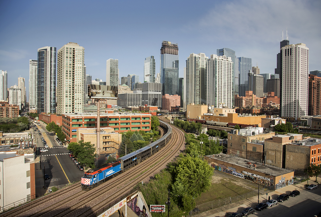
Early in summer, I found myself virtually scouring the streets of Chicago looking for locations that would afford a nice view of Metra commuter trains and the Chicago skyline. Chicago’s afternoon commuter rush is like fish-in-a-barrel as trains roll west in great afternoon light. And because of this, there’s an extensive catalog of great photos to create of F40PHs leading bi-levels headed for western suburbs. But I wanted to find something a bit different. And in this quest, I found Seven Ten.
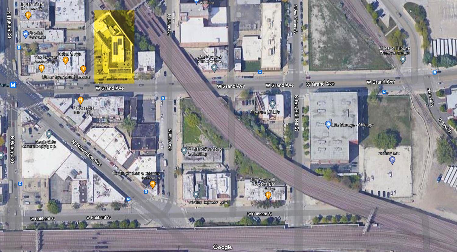
Located on the corner of W Grand Avenue and N Union Avenue in the city’s River West neighborhood, I found this casual building nestled beside Metra’s Union Pacific North Line. It was close to the summer solstice, which meant the sun was setting in the northwest, allowing nose and broadside light, and as commuter trains navigated out of Metra’s Ogilvie Transportation Center through an S curve before turning directionally west and north, and leaving the skyline behind.
Seven Ten is a residential apartment building, at nine stories above Grand Avenue, features a rooftop commons area. I zoomed in on Google Earth as if I were perched on the rooftop and sized up the shot. It looked promising, and thus I called the property manager and awkwardly explained my unusual intentions. They were cautiously accepting and non-judgmental and provided further instructions.
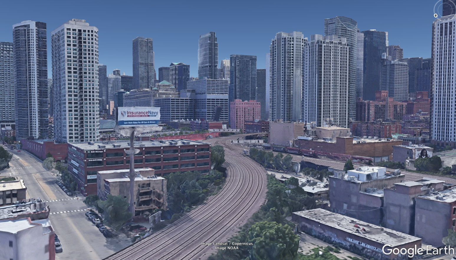
The result, captured on 6:05 p.m. local time shows Metra EMD F40PH No. 128 leading North Line train No. 363, accelerating to track speed on its daily ritual to the suburbs. A second Metra is captured in the distance and a block of covered hoppers are within eyeshot, spotted adjacent to Metra’s Union Pacific West line.
The elevation is 700’ – conservative enough for a drone, but in today’s ever-changing aerial landscape that levies more restrictions and limitations on aerial photography, the easier course of action was for this West Virginia native to find a simple rooftop, enjoy a Chicago breeze, and let Metra’s trains tell the rest of the story.