Videos & Photos Videos How To Benchwork How-to Library: Designing a layout, Part 3 Deciphering the Maps

How-to Library: Designing a layout, Part 3 Deciphering the Maps

By Angela Cotey | October 20, 2018

| Last updated on November 20, 2020


Email Newsletter

Get the newest photos, videos, stories, and more from Trains.com brands. Sign-up for email today!

Having trouble viewing this video?   Please visit our Video FAQ page
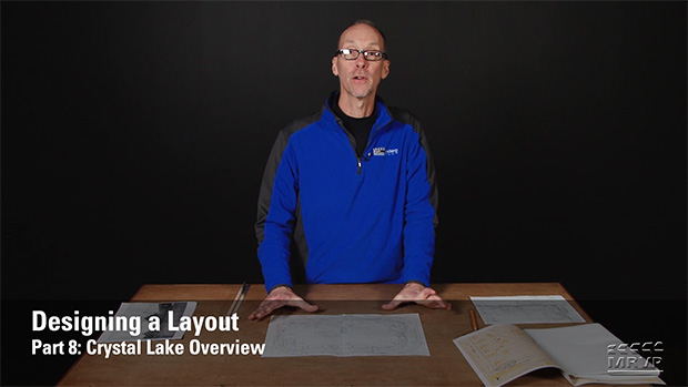
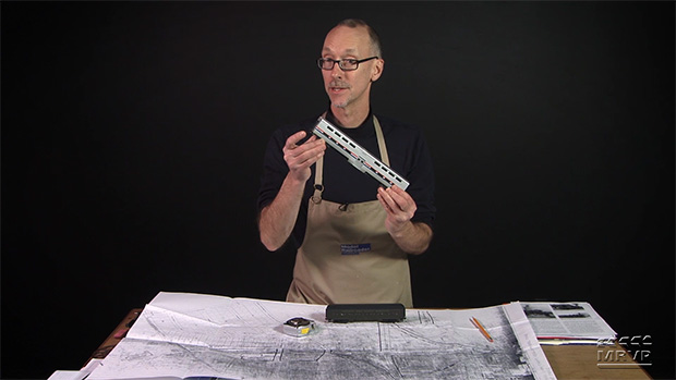
The series continues as David Popp takes a closer look at historic (Sanborn) maps to consider where and how to incorporate specific railroad trackwork, engineering, structures, industries, and more into his designs for a new layout.

20 thoughts on “How-to Library: Designing a layout, Part 3 Deciphering the Maps

  1. Sanborn maps list the scale on the overview map (always Sheet 1 of the set). The ones I have seen all use the scale of 50 feet to the inch and I believe that was probably standard. One thing David didn’t mention is the Sanborn color coding found in the map key — the color of a building indicates the structural material (e.g. Yellow = wood frame, Red = Brick, Blue = Stone, Grey = Iron, etc.). If you can’t find the Sanborn maps you need on-line, try the state or local university’s Engineering and/or Geographic library closest to the topic of your research. Often times they will have a collection of Sanborn maps. Another potential map source are “plat books” which may be found in the county Land Records/Recorder of Deeds archives or “Map and Plat rooms”.

  2. Hi David This is great information. My question is, what if you are free lancing a layout plan? Would you still use the same steps to create your plan?

  3. Having lived most of the 1960’s in Cary IL, the next town east of Crystal Lake, and even riding the CNW commuter train to Crystal Lake (to visit Frank’s Barber & Hobby Shop) on occasion, I’m very much enjoying this series. Thanks David. And heck, even though I’m primarily a Great Northern fan, I just might have to build your final layout plan. In N-scale, of course.

  4. I remem ber some of this from when I was stationed at Ft. Sheridan, ILL 1966 thru 1969. David outstanding presentation on layout planningd using the maps for a very workable layout. Thanks David.

  5. David, I may have missed an earlier video. Where and how can we obtain the Sanborn maps? Are they RR specific or area of the country specific? I am modeling the transition era with NYC and PRR, primarily from Ohio to the east. What amount of money are we having to pay for them? I enjoy your videos. Thanks.

  6. David, having grown up in Crystal Lake you may also remember the Bauer Oil Company located, I believe,
    on the end of the Schram (sp?) Green House spur across and down the line a bit from the green house. It was a very nice, small bulk oil dealer. To answer Mark’s question about parking lots, Crystal Lake is very much a “bedroom community”. Those lots are filled with commuters’ vehicles especially during the work week. As David mentioned in an earlier installment, commuter traffic is so large in Crystal Lake, a new, second depot and huge parking lot was built about a mile east of the original depot in the 2000s to accomodate the overflow. To answer Dustin’s question, no interlocking tower was needed at the junction of the CNW Northwest Line and the Lake Geneva Line because the Lake Geneva Line went UNDER the Northwest Line, a nice detail I’m sure DAvid will be noting in a future installment.

  7. For Mark D: The parking lots are big because Crystal Lake is a big commuter loading point for folks who live out there, but commute into Chicago.
    For Dustin W: The line going from West Chicago to Lake Geneva actually goes under the NW line, hence no interlocking tower. In a Google map street view, you can see the pile trestle-work for the NW line to cross over the Geneva line. Would be an interesting feature to model.

  8. It’s also interesting to view Google Earth’s view of what Crystal Lake, IL. looks like today. Yes, much of the industries are gone, but the main tracks are still there, as is the depot. Where your Crystal Lake Lumber was located there are very large parking lots there now. Since you are from Crystal Lake, David, do you know why there are such huge parking lots here? There is also a big parking lot to the North of the tracks. All of these parking lots are within three blocks from the depot.

  9. Two questions. 1) I love the MRVP shirt! Where can I get one? And 2) was there an interlocking tower located where the two lines crossed? Excellent series David, I look forward to the future episodes!

  10. There are three maps that most modelers use in layout creation. The first is a Sanborn these maps are used if your layout is made before WWII or the steam and early diesel era. Second is a Landsat Image also called a Google Earth Map these maps are only supposed to be used if you model the modern era. The third is a Topographical Map if your layout models a yard or is set in a city DO NOT USE THE TOPOGRAPHICAL MAP! Topographical Maps only model elevation and landforms they don’t model buildings or architecture.

  11. Now I’m beginning to get the picture. Basically a lot of railroading in a reasonably sized space. You’ve got commuter traffic, through passenger service, through freight service and local freight or switching service. And, possibly some “interchange” between the east/west line and the north/south line; with (more than likely) the majority of freight coming up from the south.
    This is looking like a fun layout. Almost as much fun as the Winston-Salem Southbound.

  12. Thank you, David. I’m about to start a layout and this information you are providing is very helpful. Is that a model of the USS GERALD R. FORD on the back shelf?

  13. David, great video. I used the same elements you are using when I designed my dream layout, that I will probably never build, of the Cotton Belt line from Waco to Gatesville TX. Will you be looking at the ICC maps?

  14. Great video David on examining old mapping and photos to design a model layout. You didn’t mention it, but do the Sanborn maps have a scale to them? Also, could this new layout include add-on sections that would allow loops that intersect at the crossing to the west of town by the engine terminal. Such additions would allow signaled meets and interchange traffic as well as ingenious wiring. Thanks

  15. Impressive part 3 David of researching maps to formalize a layout representing the real thing. Present day Crystal Lake looks much different as I try to visualize where the abandoned tracks/industries once stood. I’ll have some questions when I see you at Trainfest.

You must login to submit a comment