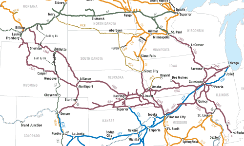
What have the mergers that built today’s Burlington Northern Santa Fe system accomplished? It’s important to ask this question, because it predicts where BNSF might be headed in the future. In basic terms, mergers have four outcomes. Strategic mergers create seamless service in new or existing traffic lanes and open new markets. Tactical mergers reduce […]
Read More…
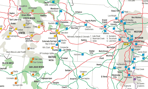
Coal is the No. 1 rail-shipped commodity by tonnage in the U.S., and power plants consume most of it. Three key characteristics shape this map (see June 2002 Trains for the East, and January 2003 for the South): Population is concentrated in cities; most plants are mine-mouth or near the mine; and its most populous […]
Read More…
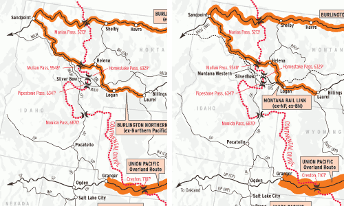
This is a snapshot of traffic across the Continental Divide in 1980 and 2000 on U.S. transcontinental routes. It’s inherent in map-making that accuracy gets sacrificed on the altar of clarity: traffic density is by no means uniform across the shaded line segments, and a slightly different picture would emerge were the snapshots taken in […]
Read More…
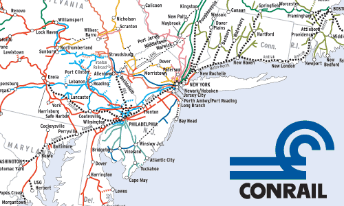
This map has been almost 25 years in coming. As soon as Conrail was formed in 1976, Trains readers began requesting a huge “breakdown” map of Conrail coded to predecessor railroads. The project was too big for the limited resources then available to us. Thanks to Curt Richards, though, we now have a good source […]
Read More…
Compared here are the world’s most important main lines across the most important freight territory on earth, at a time when railroads were the most important of man’s technologies, 1927. These four main lines were the Trunk Lines, a title originally given to any important main line between two great cities, but later reserved almost […]
Read More…
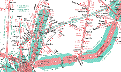
The New Haven’s heavy passenger orientation is obvious, especially on the New York-Boston Shore Line. On the electrified West End, torrents of commuters flowed in and out of New York’s Grand Central Terminal. Some intercity runs used GCT too, while a relative handful of trains bound to and from points west of New York used […]
Read More…
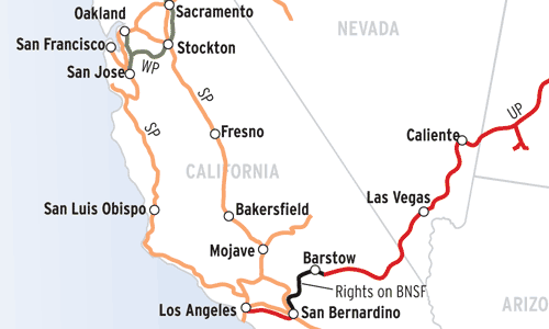
Jeff Wilson and Robert Wegner This Map of the Month appeared in the October 2004 issue of Trains magazine. It’s fitting that the largest U.S. railroad today, the Union Pacific, was born as part of a grandiose plan — to build the nation’s first transcontinental railroad. From that not-so-humble beginning, UP has grown into the […]
Read More…
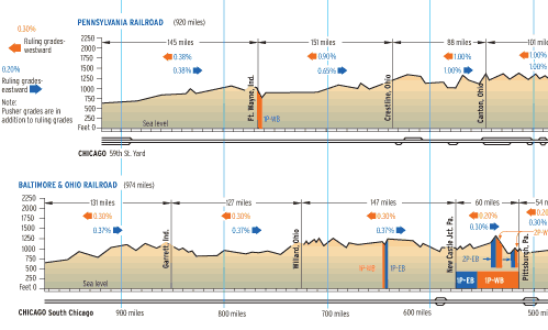
Bill Metzger This Map of the Month appeared in the February 2006 issue of Trains magazine. Mention the Pennsylvania Railroad and iconic images come to mind immediately: passenger trains rocketing down a four-track electrified main line; limiteds scooping water on the fly from track pans; impossibly long coal drags; and mammoth engineering projects, from Horseshoe […]
Read More…
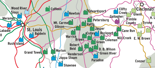
Robert Wegner This Map of the Month appeared in the January 2003 issue of Trains magazine. This is the second in our series of coal-fired power plant maps of the U.S. The first, showing the Northeastern quadrant of the U.S., appeared in June 2002 Trains. Electrical generation in the South obeys a much different pattern […]
Read More…
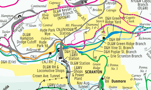
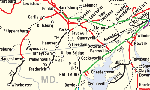
Dave Crosby and Bill Metzger This Map of the Month appeared in the April 2008 issue of Trains magazine. Delaware & Hudson Canal Co.’s 1826 Gravity Railroad over Moosic Mountain first hauled anthracite coal from Northeast Pennsylvania to New York City. By 1888, seven major railroads and several smaller lines tapped the rich coal seams […]
Read More…
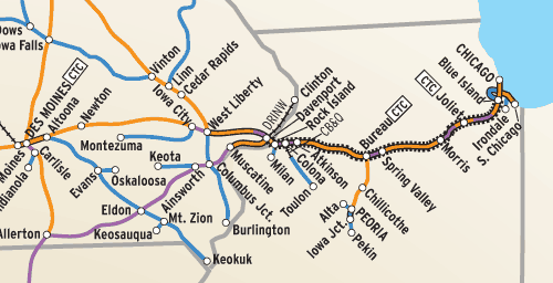
Bill Metzger This Map of the Month appeared in the October 2005 issue of Trains magazine. Rock Island Lines serve 14 Western states,” the Chicago, Rock Island & Pacific’s map in the Official Guides of 1964 proudly proclaimed, offering “7,849 miles of modern railroad.” Trouble was, Rock Island’s main lines went everywhere its parallel rivals […]
Read More…
Jeff Wilson and Robert Wegner This Map of the Month appeared in the February 2007 issue of Trains magazine. Twenty-five years separate these two maps showing the busiest freight railroad lines in the United States. The 1980 map depicts American railroads at the end of regulation — the Staggers Rail Act of 1980 was signed […]
Read More…
