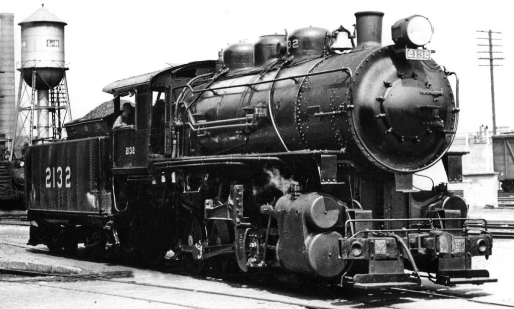
A photo illustration shows what No. 2132 might look like restored. Photo illustration by Ron Flanary BAINBRIDGE, Ga. – The Bainbridge city council has voted to transfer ownership of former Louisville & Nashville C-1 class 0-8-0 No. 2132 to the city of Corbin, Ky. Also included is former L&N caboose No. 30, built at South […]
Read More…

For his second day in the Denver area, host Drew Halverson explores more of the Front Range, before returning to other railroad sites in the Mile-High City. Drew also joins pal Mike Danneman for stops at the recently-renovated Denver Union Station and an extra special ride on the Colorado Railroad Museum’s K-37 steam locomotive. […]
Read More…
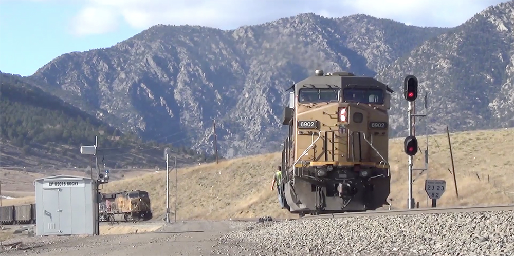
Host Drew Halverson ventures to Denver, Colo., home of his beloved Broncos. But more importantly, it’s the starting point for UP’s Moffat Route over the Continental Divide. Good pal Mike Danneman leads the MRVP crew out of the city and into the Front Range for a day of dramatic views and action along the curvaceous, […]
Read More…
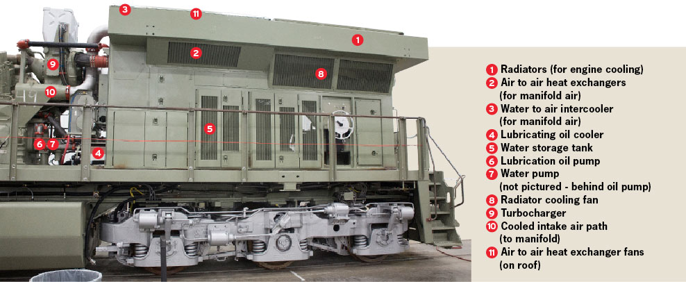
A BNSF ES44C4’s radiator assembly in the plant at Fort Worth, Texas. Both GE and EMD radiator sections are prebuilt and set onto the frame during assembly. Chris Guss Locomotive engine heat, left uncontrolled, can damage engine parts and shorten the life of the engine and its attached components. An effective radiator system keeps the […]
Read More…
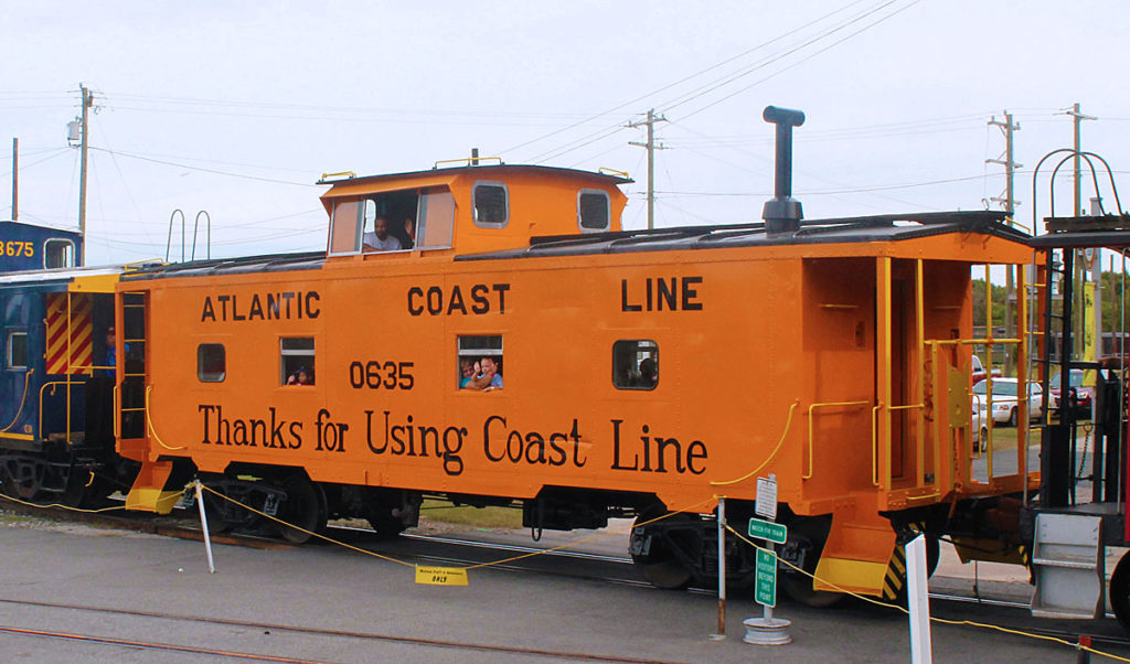
ACL caboose No. 0635 shows off its fresh paint. North Carolina Transportation Museum SPENCER, N.C. – Volunteers from the North Carolina Transportation Museum have repainted former Atlantic Coast Line caboose No. 0635 to its original ACL orange scheme with black lettering. It is the second restored Atlantic Coast Line caboose at the museum. According to […]
Read More…
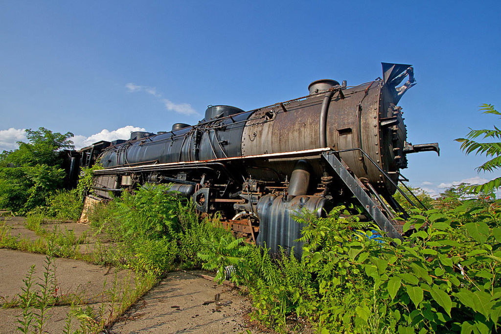
No. 643 at McKees Rocks in summer 2014. Steve Glischinski PITTSBURGH – The saga of Bessemer & Lake Erie 2-10-4 No. 643, which has long languished in outdoor storage in McKees Rocks, may finally be coming to a close. According to a report in the Pittsburgh Tribune-Review, the locomotive may be put on display in […]
Read More…
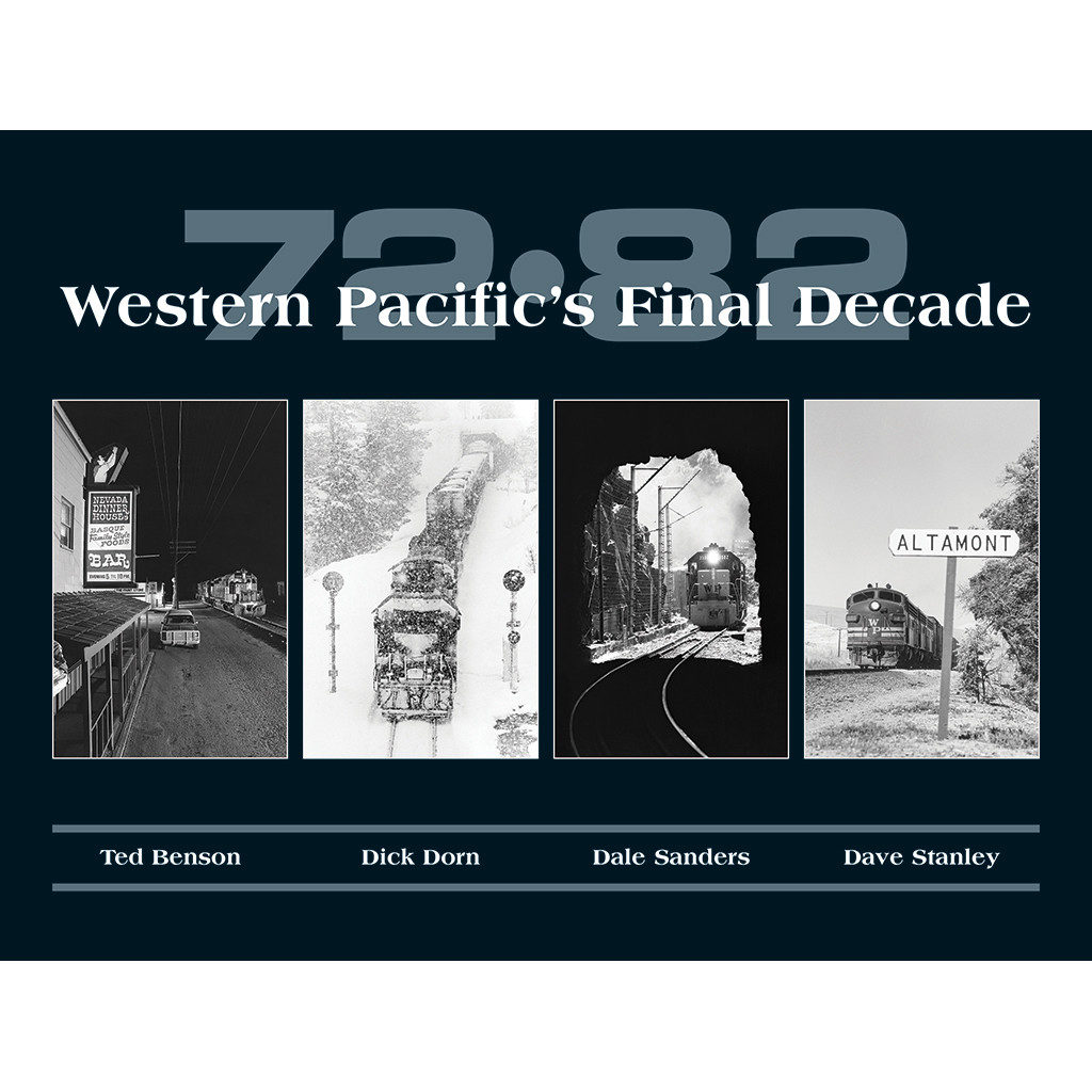
72-82: Western Pacific’s Final Decade by Ted Benson, Dick Dorn, Dale Sanders, Dave Stanley White River Productions, P.O. Box 48 Bucklin, MO 64631; 240 pages, hardcover, 12.25 x 9.25 inches; $79.95 www.whiteriverproductions.com North American railroading wasn’t always dominated by super-sized Class I railroads and a smattering of so-called regionals and short lines. Not that long […]
Read More…
Stand next to Trains‘ Steve Sweeney with video from Cass Scenic Railroad’s annual railfan weekend in 2014. Steve caught Cass’ Heisler No. 6 hauling a short freight, a triple-headed Shay consist, and the grand parade of steam. See steam railroading at its best, in the West Virginia mountains, only from Trains! […]
Read More…

City of Ottawa OTTAWA, Ontario – Officials from local and national government agencies joined in Ottawa last week to unveil the future of transit with a full-sized mockup of the Alston Citadis Spirit light rail vehicle. The vehicle will be used on the O-Train Confederation Line, the backbone of Ottawa’s new light rail transit system. […]
Read More…
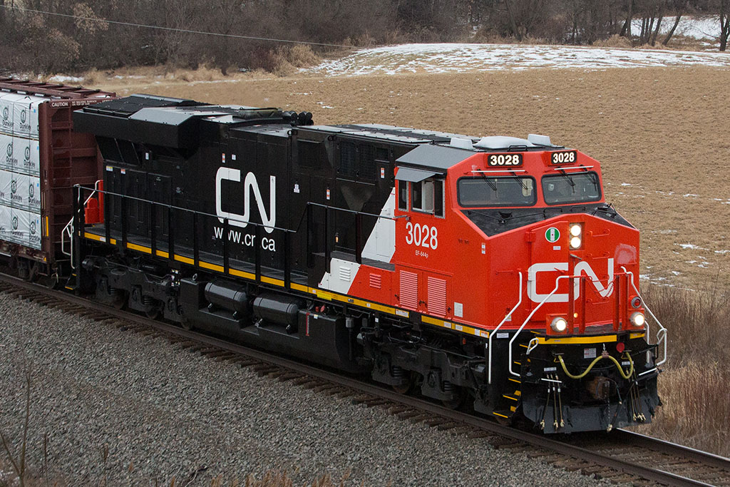
New CN Tier 4 Credit User ES44AC No. 3028 leads a train south through Wisconsin on Jan. 29. Craig Douglas ERIE, Pa. – General Electric has begun shipping the first of its Tier 4 “Credit User” locomotives to customers this month. Both Canadian National and BNSF Railway are the first to receive new locomotives from […]
Read More…
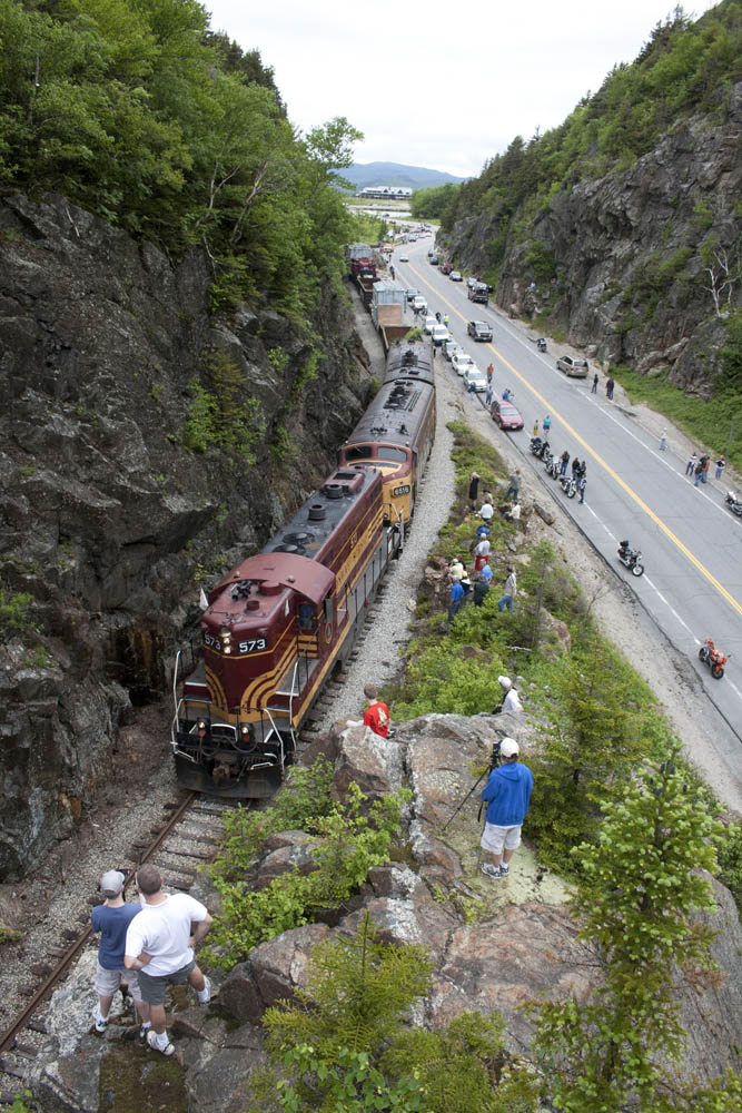
The last freight move over Crawford Notch, in 2009, drew hundreds of onlookers and railfans. Justin Franz CRAWFORD NOTCH, N.H. – More than three decades after the last Maine Central freight trains crossed the legendary Mountain Division over Crawford Notch, the New Hampshire Department of Transportation is looking to see if anyone is interested in […]
Read More…
