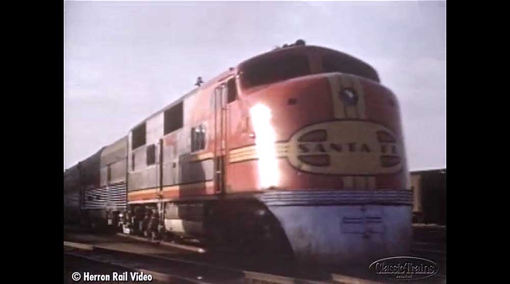
Watch a video clip of Santa Fe E1’s on a San Diegan meeting a 4-6-2 with the former Valley Flyer train from the DVD program Glory Machines, Vol. 1, produced by Herron Rail Video. […]
Steam and diesel on Santa Fe’s Surf Line
Watch a video clip of Santa Fe E1’s on a San Diegan meeting a 4-6-2 with the former Valley Flyer train from the DVD program Glory Machines, Vol. 1, produced by Herron Rail Video. […]
Watch a video clip of Santa Fe E1’s on a San Diegan meeting a 4-6-2 with the former Valley Flyer train from the DVD program Glory Machines, Vol. 1, produced by Herron Rail Video. […]
FORT WORTH, Texas — BNSF Railway has launched an interactive map that showcases various events and activities along its transcontinental rail system. The map uses various markers to highlight events such as community projects, news updates, photos, and videos along with historical information. Users have the ability to filter the data and zoom into a […]
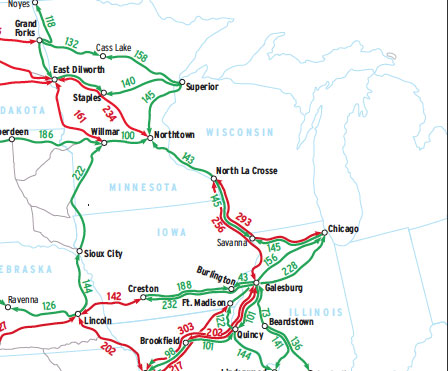
This Map of the Month appeared in the May 2004 issue of Trains magazine. If a system map is an archaeological record of mergers, acquisitions, abandonments, and line sales, then a crew-district map is the record of all of these, plus technological change and traffic pattern change, with a great deal of law and contract negotiations […]
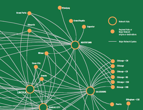
This Map of the Month appeared in the January 2004 issue of Trains. Al first glance, this looks like the route map of an airline. In reality, it’s BNSF Railway’s merchandise freight traffic network (i.e., cars not moving in unit trains from one common origin to one destination). It’s no coincidence they look the same, for […]
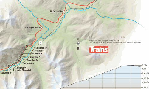
Great Northern Railway’s St. Paul, Minn.-Seattle transcontinental main line, now part of BNSF Railway, was built in the early 1890s as the northernmost such route in the United States, crossing the Continental Divide in the Lewis Range at Marias Pass, 5,213 feet above sea level. The Great Bear Wilderness in Lewis and Clark National Forest […]
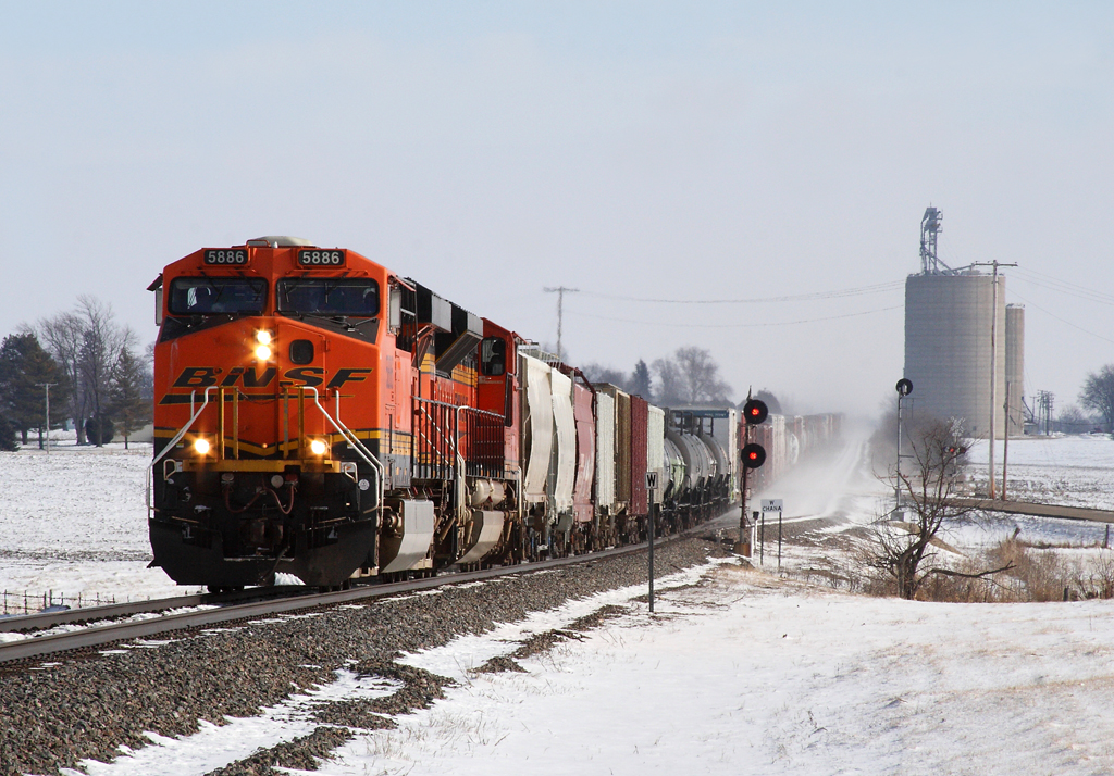
A westbound Z-train roars through West Chana, Ill., on the BNSF Aurora Sub. Photo by Nathan Beecher […]
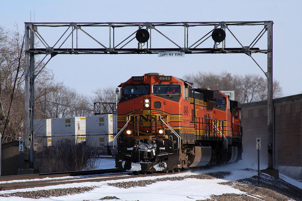
A westbound BNSF Z-train, hauling new J.B. Hunt Intermodal containers, pounds the diamonds at Rochelle, Illinois. Photo by Nathan Beecher […]
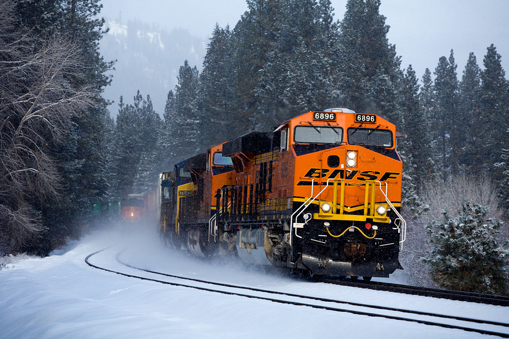
Intermodal trains pass at Winton, Wash., a short ride east of the Cascade Tunnel at Stevens Pass. ES44C4 No. 6896 is leading Seattle-Chicago train Z-SSECHC6-19A, while the distributed power unit of Tacoma, Wash.-bound train S-STPTAC3-16A disappears into a fog of snow. Photo by David Honan […]
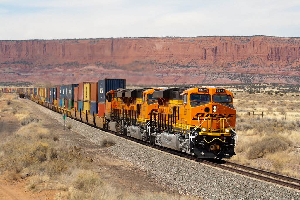
A trio of General Electric-built GEVO locomotives powers an intermodal rain past North Guam, N.M., on April 11, 2011. The first two diesels belong to the class ES44C4, an A1A-A1A-trucked A.C. traction model built to perform to six-motor D.C. designs. Photo by Steven M. Welch […]
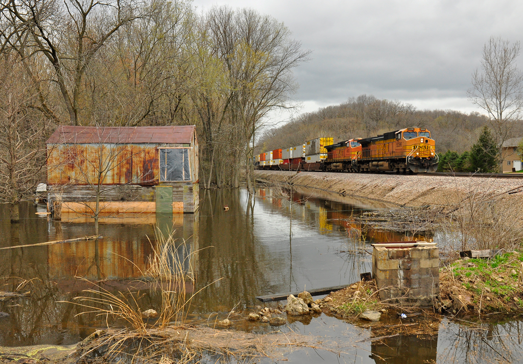
The spring flood waters have started to subside on the Mississippi River (as evidenced by the watermarks on the trees) at Gears Ferry Landing near Galena, Ill., as an eastbound BNSF “Z” train heads east toward Chicago on a cloudy and cool April 23, 2011. Photo by Steve Bauer […]
Q How does BNSF’s Network Operations Center in Fort Worth, Texas, control BNSF trains when they share tracks with another railroad, such as the route over the Tehachapi Pass? Union Pacific owns the trackage and allows BNSF trackage rights. On average, BNSF sends three trains over the pass to UP’s one. Does the BNSF Operations […]
