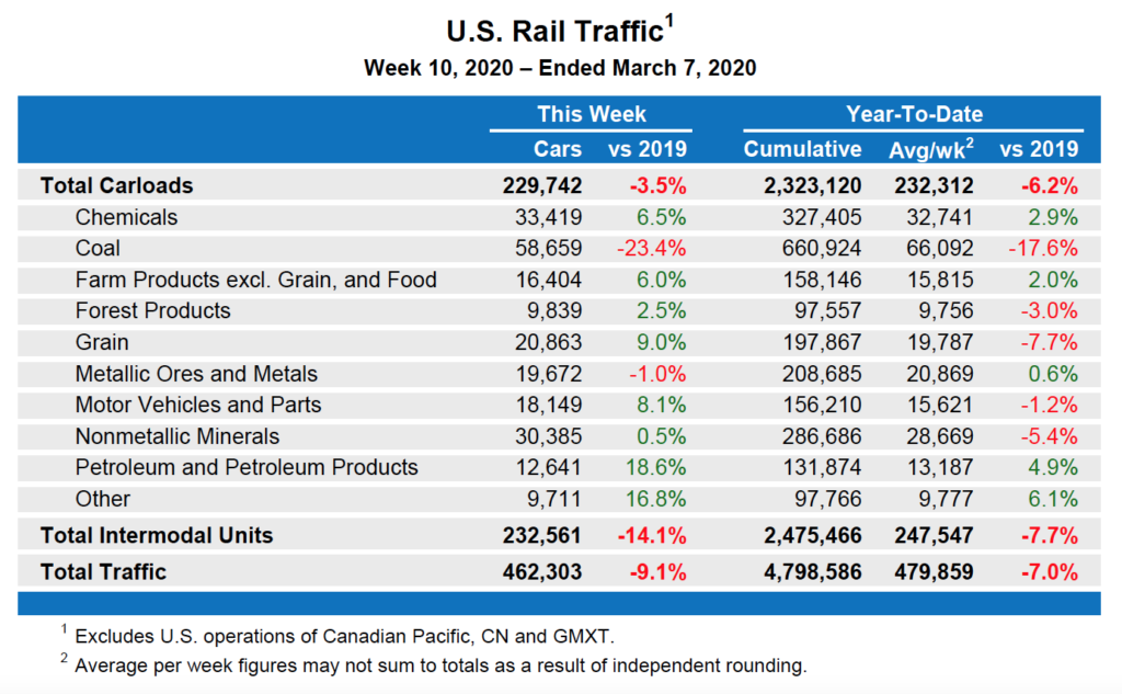
Association of American Railroads WASHINGTON — The Association of American Railroads today reported U.S. rail traffic for the week ending March 7, 2020. For this week, total U.S. weekly rail traffic was 462,303 carloads and intermodal units, down 9.1% compared with the same week last year. Total carloads for the week ending March 7 were […]
Read More…
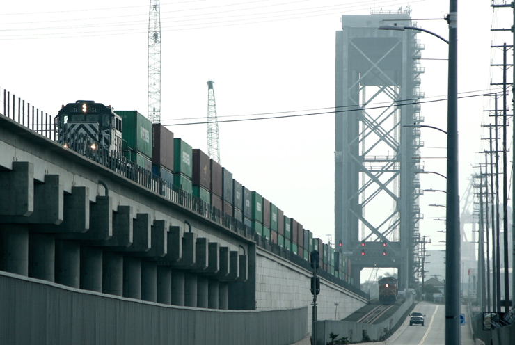
A Pacific Harbor Line train works at the Port of Los Angeles in January 2018. Traffic at the port was down significantly in February, and railroad officials anticipate a significant decrease in international intermodal traffic, because of the coronavirus. TRAINS: David Lassen NEW YORK – The full impact of the global coronavirus epidemic will soon […]
Read More…

WASHINGTON — Union Pacific has been negotiating a sale of its dormant Tennessee Pass route with Rio Grande Pacific, the short line holding company that would operate a new railroad proposed to haul heavy crude oil out of Utah’s Uinta Basin. The information was accidentally disclosed in a filing posted briefly to the Surface Transportation […]
Read More…

The Wednesday morning rail roundup: — In a significant blow to the fledgling commuter rail service, California voters in Sonoma and Marin counties have turned down a measure extending the quarter-cent sales tax that funds Sonoma-Marin Area Rail Transit. Approval of the measure would have guaranteed funding through 2059, the Santa Rosa Press-Democrat reports; without […]
Read More…

New MARS President Stefan Loeb, left, is congratulated by outgoing president Tom Surma, who was honored for his leadership at the 2020 Winter Meeting in January. MARS submitted photo CHICAGO — The Midwest Association of Rail Shippers (MARS) elected its 2020 slate of officers at the annual winter meeting earlier in January. The 2020 MARS […]
Read More…

WASHINGTON — Local legislators and recipients are beginning to announce that they have been awarded Federal Railroad Administration grants for infrastructure projects. The Consolidated Rail Infrastructure and Safety Improvement (CRISI) grants can be used for passenger projects, grade-crossing improvements, capacity projects and other rail projects. Among those announced so far: — $21.5 million to the […]
Read More…
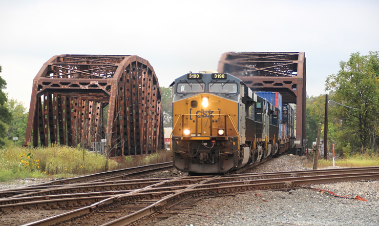
A CSX train passes through Blue Island, Ill., in September 2019. CSX led Class I railroads in operating ratio in 2019. TRAINS: David Lassen The operating ratio at every Class I railroad fell below 65% for the first time in 2019 as the industry average improved to an all-time low of 61.9%. The increased profitability […]
Read More…

As one rail blockade remains in place in Canada, the political and financial toll of the three-week disruption to rail transportation continues. A poll taken in the wake of Canada’s series of rail blockades finds that only 27% of those responding feel Prime Minister Justin Trudeau has handled the situation well, while 45% approve of […]
Read More…
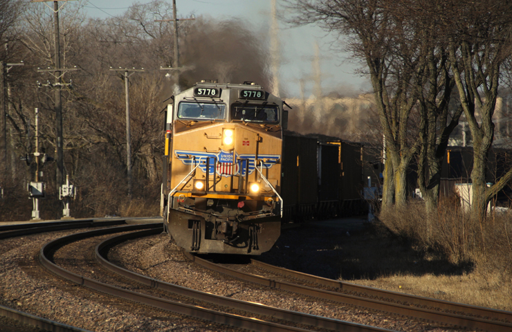
A Union Pacific coal train heads east through Glen Ellyn, Ill., on Feb. 23, 2020. The railroad’s coal traffic has hit bottom as low natural gas prices lead to shutdowns of coal-fired power plans, according to CEO Lance Fritz. TRAINS: David Lassen MIAMI BEACH, Fla. — Union Pacific’s coal traffic — which is down 30% […]
Read More…
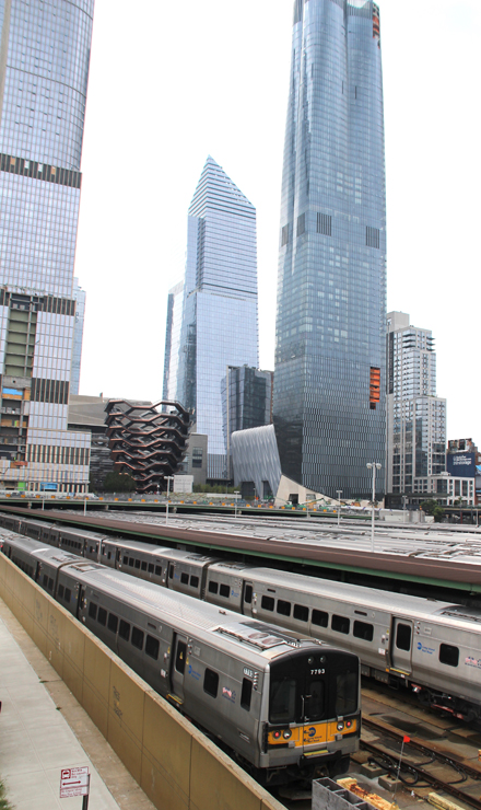
Amtrak and real-estate firm Related Companies will pursue funds from the Department of Transportation for the next phase in the development of Manhattan’s Hudson Yards. TRAINS: David Lassen More Tuesday morning rail news: — Related Companies, the real estate firm which led the building of the first part of Manhattan’s Hudson Yards development, has signed […]
Read More…
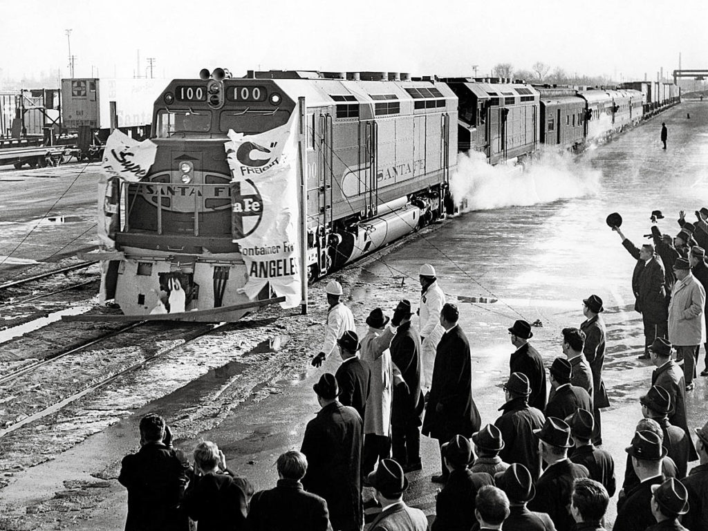
Santa Fe’s high-priority Super C freight between Chicago and Los Angeles debuted with much fanfare in 1968. High rates, charged to placate other Santa Fe customers, limited traffic, however. Santa Fe photo […]
Read More…
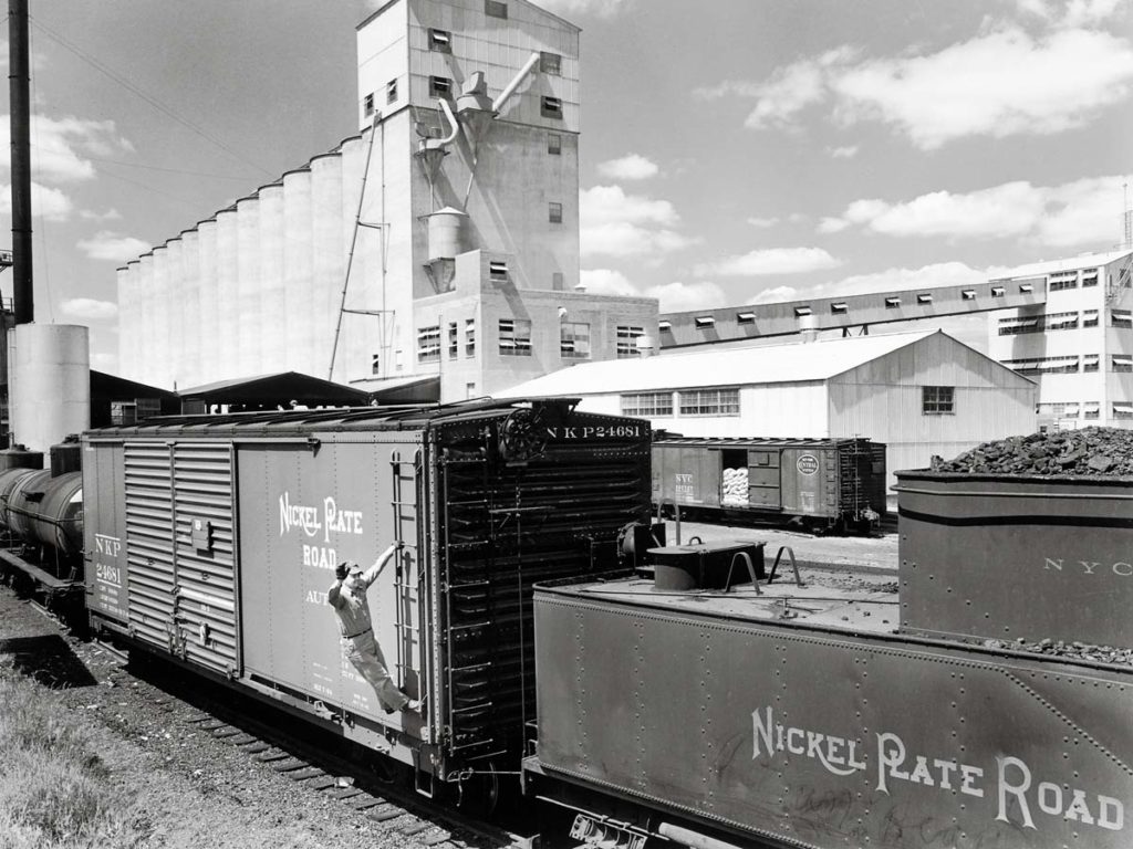
Swift & Co. had a large soybean processing plant on the Nickel Plate Road at Frankfort, Ind. In this 1946 view, beans arrived by boxcar, with outbound soy meal loaded in sacks in boxcars (the boxcar in the background) and soybean oil loaded in tank cars. Nickel Plate Road photo […]
Read More…
