


Oculus Rail, a startup company based in Norfolk, Va., wants to cure a railroad headache: Frequently blocked grade crossings that frustrate motorists and communities alike.
The company aims to build a grade-crossing sensor network that can help reroute traffic and emergency vehicles around blocked crossings. Oculus Rail — which launched a smartphone app last week after a yearlong pilot program at 40 grade crossings in the Hampton Roads area of Virginia — says its system can monitor crossings, collect data, and provide alerts in real time.
The data also can help communities determine the most problematic grade crossings — and then find solutions, ranging from building overpasses to coordinating traffic signals so alternate routes don’t become plugged when a busy crossing is blocked.
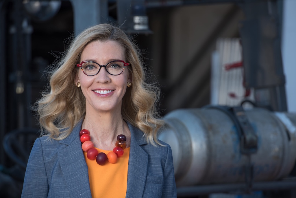
“We were able to test our technology where it matters most,” Oculus Rail founder and CEO Andria McClellan says. “By working directly with local governments across different settings — urban downtowns, busy port areas, suburban neighborhoods, and rural crossings — we’ve developed a data platform that’s scalable, resilient, and immediately useful to cities across the country.”
No comprehensive set of data exists on how long or how frequently grade crossings are blocked by stopped or slow-moving trains. There’s also no federal regulation regarding how long crossings may be blocked, and states and local communities cannot enforce their own crossing rules.
Complaints about blocked grade crossings have been increasing in recent years, however, as train lengths have risen, according to the Federal Railroad Administration. In the past 12 months, the FRA has collected 25,718 complaints through the blocked crossing portal on its website.
McClellan served on the Norfolk City Council for eight years, where she chaired the regional transportation commission, launched the Smart Cities and Innovation Committee, and heard more and more grade crossing complaints from area residents. She founded Oculus Rail because of the way blocked rail crossings disrupt traffic, delay emergency responders, and annoy residents — with little data available to quantify the problem.
“Local governments have been operating in the dark when it comes to blocked crossings,” says McClellan, who is married to Michael R. McClellan, Norfolk Southern’s senior vice president and chief strategy officer. “I started Oculus Rail to give cities and residents the data they need to make informed decisions, improve safety, and advocate for solutions with railroads and federal partners.”
The company has drawn advisory input from Class I railroad leaders and the U.S. Department of Transportation.
McClellan estimates that 10% of the 125,000 public grade crossings in the U.S. are problematic enough to warrant the Oculus Rail system.
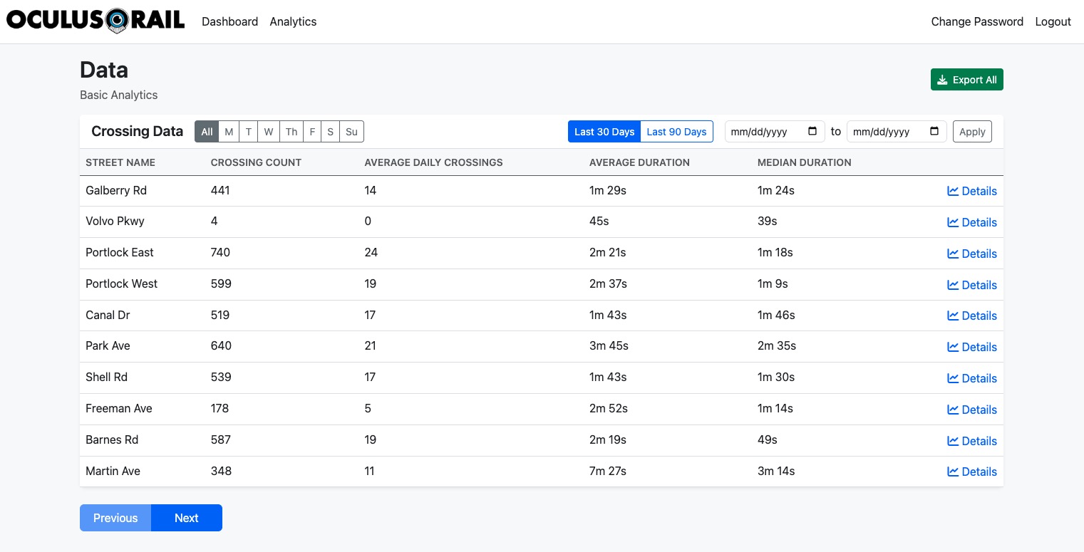
Oculus Rail’s solar-powered, wireless sensors capture real-time data on blocked rail crossings, showing when and how long crossings are obstructed and how often trains impact traffic and emergency response times. The company’s analytics dashboard provides cities, regional planners, and public safety agencies with insights to reduce congestion, improve emergency response, and guide infrastructure investments.
McClellan says the Oculus Rail business model — sell data to local governments, rather than expensive sensor equipment — is the best way to approach the problem due to its lower costs and placement of sensors on public property, rather than the railroad right-of-way.
Some competing sensor systems can cost more than $150,000 per grade crossing and saddle the local government with ongoing maintenance costs. In contrast, Oculus Rail owns the sensors and is responsible for their upkeep. An annual data subscription costs between $2,500 and $5,000 per grade crossing. An Indiana company, Interfact, is taking a similar approach with a few crossings in Muncie and Vincennes, Ind.
What makes Oculus Rail different, McClellan says, isn’t just the technology. “It’s the team and target. We’ve combined AI and sensor hardware with a deep, first-hand understanding of how cities, state DOTs, and railroads actually operate,” she says. “That’s why we were able to design and deploy a 40-sensor testbed across four different municipalities … something no one else has done.”
“Because ours is solar powered and wireless, we don’t need any connectivity from the locality, no big engineering study that’s often costly and takes a long time to complete,” she says.
“Once the municipality purchases that data, we install the sensor. That becomes live in our app, and the app is free to any motorist,” McClellan says. Motorists can select the grade crossings they want to receive alerts about.
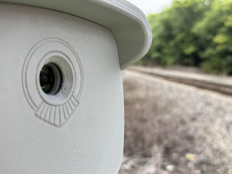
The sensors take still images every 30 to 40 seconds. The images are sent to a database, where artificial intelligence views the images to determine whether a crossing is clear or blocked and for how long. The information is then sent to the app to alert motorists.
The next step to provide more proactive alerts will be adding geofencing capability, which would trigger an alert when a motorist is within a few miles of a blocked crossing.
The crossing data also may be helpful to railroads, McClellan says. Aside from the train crew no one at the railroad knows when a crossing is blocked by a stopped train. The Oculus Rail data could be sent to yardmasters or dispatchers when a crossing is blocked for longer than a specified time, McClellan says.


“There’s also no federal regulation regarding how long crossings may be blocked, and states and local communities cannot enforce their own crossing rules.”
— This is the problem that needs to be addressed. Communities need to be able to protect from school kids crawling under trains to get to school on time, and emergency vehicles having no reasonable way to reach a target location. How often is a train blocking multiple crossings or leaving the next open crossing miles away? We’ve all read about these kinds of events. Many communities can’t afford to build grade separated crossings! It’s the operation of the railroads that needs to change.
It’s nice that Oculus is trying to make blocked crossings data available. I would like to see maximum duration and variance data added to the dashboard, as well as distributions of times of day of recurring blocking events. And I’d sure like to see a way other than pulling out my phone and calling up an app to see if I can get my friend having a medical emergency to a hospital across the tracks, now or five minutes from now.
Beware the use of “AI” in marketing claims. There may be some AI in the Oculus approach for whatever reason. But I know from experience tracking vehicular behavior on residential streets ten years ago, also in Virginia, that this kind of tracking can be done quickly and easily, algorithmically, using a free software library called OpenCV and a $100 camera! (My data was used to convince the legislature to allow speed cameras in school zones and work zones.) My point being, don’t pay for “AI” unnecessarily. This kind of tracking can be done very inexpensively.