Brass Expo 2016 was held on October 1 and 2 at the Westin Hotel in Wheeling, IL (The Chicago North Shore). The show featured manufacturers, historical displays, and some of the finest brass railroad models in the world. James Wright of the JLWII2000 YouTube channel attended the show and provides this VIP look. […]
Read More…
A Chessie System train led by two Geeps (ex-B&O and WM) passes under a skewed pony truss bridge of the Akron & Barberton Belt Railroad in Akron, Ohio. John Beach photo […]
Read More…
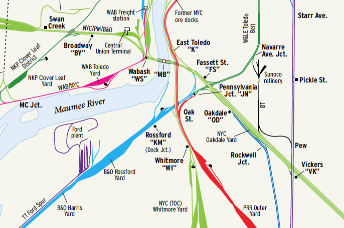
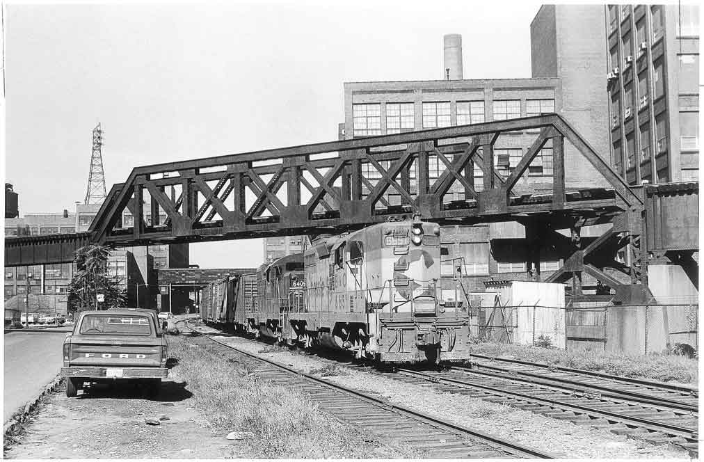
Toledo, Ohio, has long been a center of industry. Nicknamed the “Glass City” for its prominence in glassmaking, the city is also home to the iconic Jeep brand and a busy Great Lakes port. Toledo Terminal Railroad used its circular route to connect the city’s industrial base with national and world markets. One can still […]
Read More…
A southbound Norfolk Southern freight takes the siding at South Leesburg, Ind., on May 16, 2011. The former New York Central branch line was upgraded with Pennsylvania-style position light signals recycled from other routes during Penn Central ownership. Photo by Bob Jordan […]
Read More…
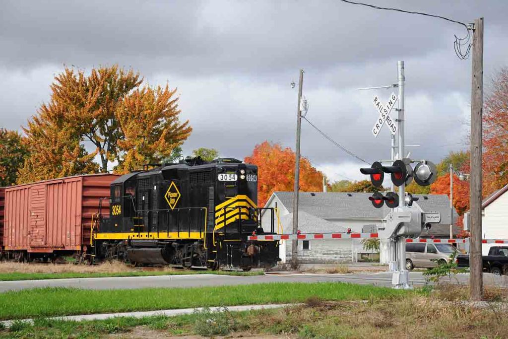
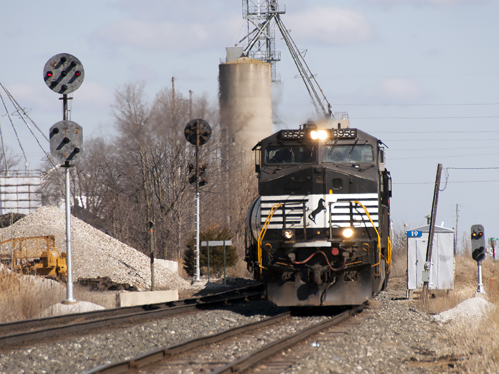
An eastbound Napoleon, Defiance & Western train passes the new crossing gates at Scott Street in Napoleon, Ohio, on Oct. 19, 2014. The new grade crossing protection is arguably the newest equipment of any kind on this short line. Photo by Brian Schmidt […]
Read More…
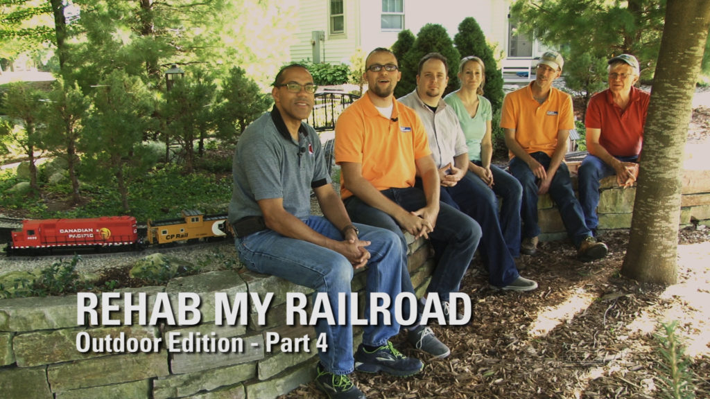
Having trouble viewing this video? Please visit our Video FAQ page In this concluding episode of the Outdoors series, David follows the advice of previous guest Marc Horovitz, and builds a concrete bridge abutment for a troublesome trestle. Kent teams with Rehab: Seasons 1 and 2 host Chuck Sable to install IR signals for […]
Read More…
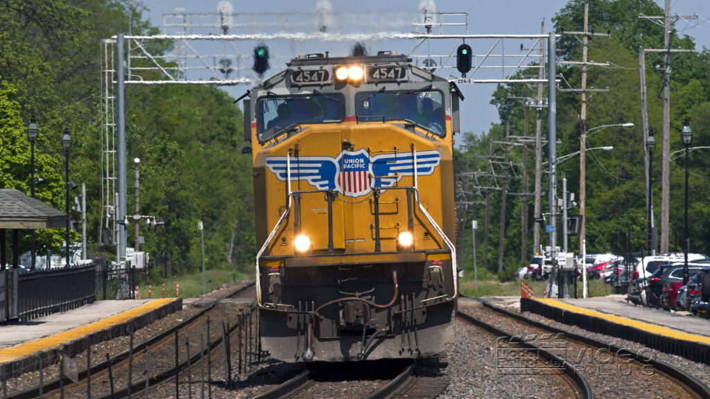
No summertime blues for host Drew Halverson this year! That’s because he managed to begin his summer of trackside treks with a day trip to the Windy City. Upon arrival in West Chicago, Ill., Drew, Kent, Ben, and special guest Kevin P. Keefe, chased Union Pacific freight and a parade of Metra commuter trains along […]
Read More…
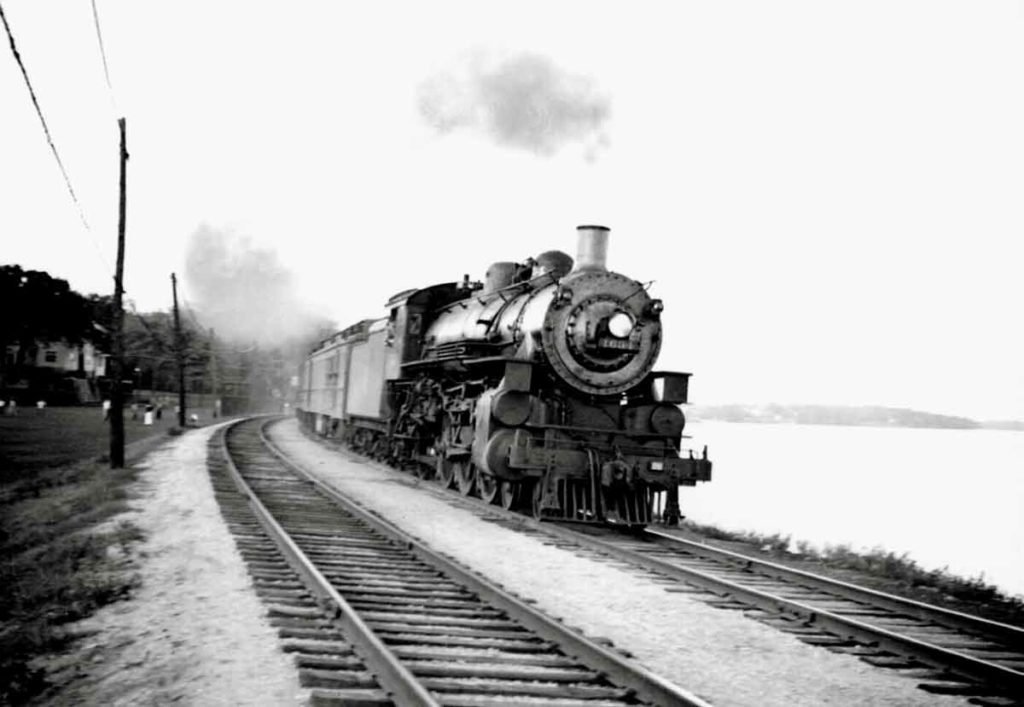
Running left-handed per C&NW practice, E-class Pacific 1634 skirts Lake Monona as she departs Madison with the evening local to Chicago. Frank Rogers Back in the days when there were enough railroad companies to make train-watching really interesting, Madison, Wis., was served by three: the Milwaukee Road, the Chicago & North Western, and the Illinois […]
Read More…
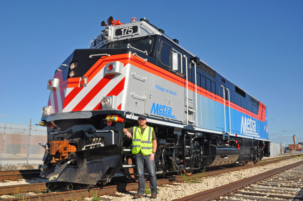
Metra’s newly re-built F40PH no. 175 arrived in early September from Progress Rail Services Metra Engineer Kyle Nanfeldt stands in front of the locomotive, which wears a paint scheme he designed. Mark Llanuza The cover of Locomotive 2016, on-sale in late September. CHICAGO — Metra, Chicago’s commuter operator, received its first rebuilt F40PH No. 175 […]
Read More…
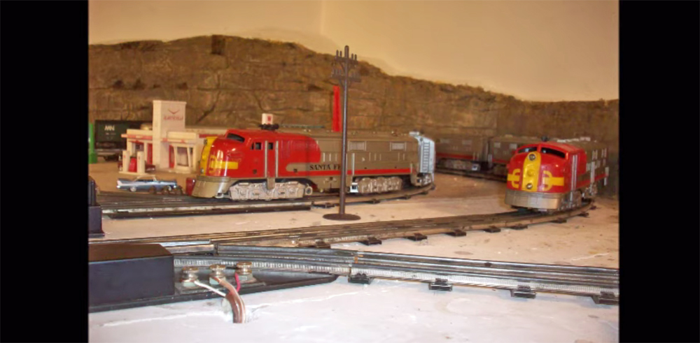
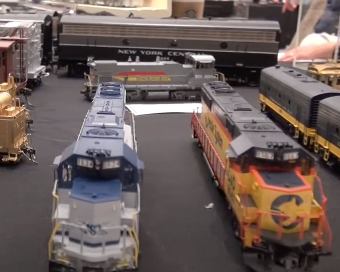
Name: Todd Hein Forum User Name: ToddH Railroad Name: Minneapolis Northern Location: Crystal, Minnesota Scale: O gauge Theme: Marx E7s Description: Two Santa Fe trains pulled by Marx E7s invade the Minneapolis Northern Railroad. […]
Read More…
