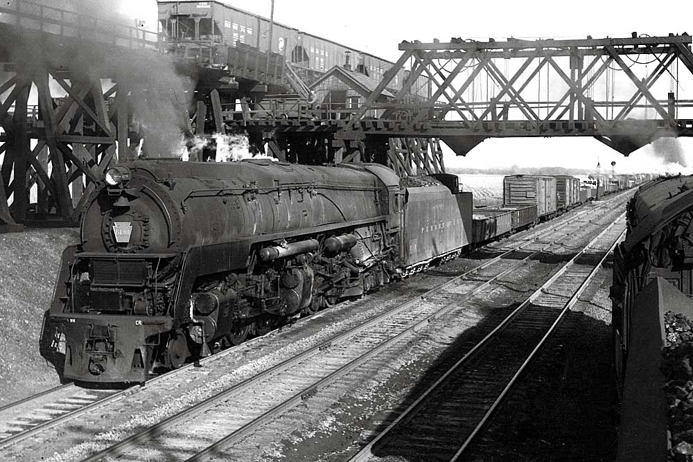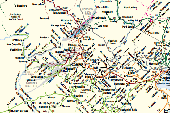
The Northeast was laced with anthracite roads — those carriers that made a name for themselves hauling hard coal out of the mountains of northeastern Pennsylvania. With its high heat value, clean-burning anthracite was far superior to wood for warming homes and offices, and moving this coal by rail fueled the growth of the East’s major cities. As oil and gas became preferred heating methods, area railroads went after bridge traffic from gateways such as Scranton/Wilkes-Barre, Pa., and Buffalo, Maybrook, and Albany, N.Y. Only the Erie Railroad made it west of Pennsylvania, reaching Chicago.
This map shows the disposition of eight anthracite roads as they existed in 1954, when hard coal production was a fifth of what it had been 40 years earlier. (The Susquehanna, a ninth coal-hauler, left Pennsylvania in 1941, and so appears only as a current-day operator of others’ lines.) The lines shown encompass about 6,600 route-miles. By the 1960s, two carriers would shut down completely: Ontario & Western and Lehigh & New England. The rest would eventually accrete into larger systems, their networks parceled out or abandoned.
About half the trackage from 1954 remained in service in 2009, much of it run by commuter agencies, short lines, and regionals. One railroad, Reading & Northern, still got almost one-fifth of its traffic hauling anthracite.
Map research assistance provided by Rick Bates, Gerald Bertoldo, Abram Burnett, Larry DeYoung, Lou Millan, Andy Ottinger, and Rich Wisneski.
Railroads included in this map:
Bath & Hammondsport; Batten Kill; Belvidere & Delaware River; Birdsboro Materials; Black River & Western; Buffalo & Pittsburgh; Buffalo Southern; Canadian Pacific; Central New York; Central Railroad of New Jersey; Clarendon & Pittsford; ConAgra Foods; Conrail; Cooperstown & Charlotte Valley; CSX Transportation; Delaware & Hudson; Delaware-Lackawanna; Delaware, Lackawanna & Western; Depew, Lancaster & Western; East Penn; Erie; Finger Lakes; Gettysburg & Northern; Landisville Terminal & Transfer; Lehigh; Lehigh & New England; Lehigh Valley; Livonia, Avon & Lakeville; Luzerne & Susquehanna; Lycoming Valley; Middletown & Hummelstown; Mittal Steel; Morristown & Erie; MTA Metro-North; New Hope & Ivyland; NJ Transit; New York & Lake Erie; New York, Ontario & Western; New York, Susquehanna & Western; Norfolk Southern; North Shore; Ontario Central; Owego & Harford; Pennsylvania Power & Light; R.J. Corman; Reading; Reading & Northern; Rochester & Southern; Shamokin Valley; SMS Rail Lines; Southeastern Pennsylvania Transportation Authority; Southern Railroad of New Jersey; Stourbridge; Towanda-Monroeton Shippers’ Lifeline; Union County Industrial; Upper Hudson River; Wanamaker, Kempton & Southern; Wellsboro & Corning; Western New York & Pennsylvania; Winchester & Wester
This map originally appeared in the June 2009 issue of Trains magazine.